


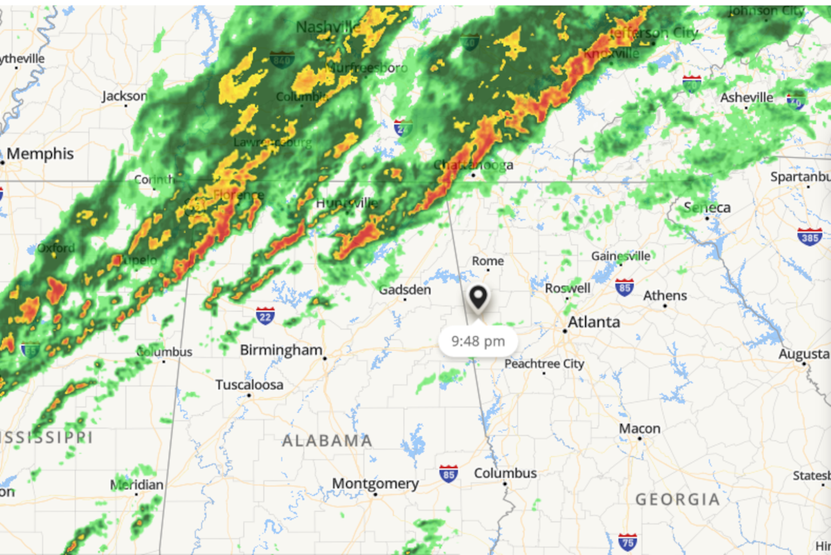
The severe weather has thus far remained far north of Polk County in Middle Tennessee, but it is heading this way and predictions put it arriving during the early Sunday morning hours.
The Polk County Emergency Management Agency reported this evening on their Facebook page they expect the severe weather to arrive after midnight, falling in line with current predictions that the Weather Channel has as well on their future cast radar.
Whether or not Polk County gets any potential severe thunderstorms from the front moving into the area, the forecast is set to be wet for the close of the weekend and the temperature is set to drop by Sunday night.
Forecasts call for the thermometer to dip below freezing overnight on Sunday, down to 29 degrees with a 70% chance of showers.
Monday is expected to only get up to 48 degrees in the updated predictions as well, and bring with it the slightest chance for early morning rain.
The biggest factor for the rest of tonight, into Sunday and Monday will be the wind. Gusts overnight are expected to get up to 25 mph, calm down on Sunday, but return by Sunday night with winds between 10 and 15 mph, and remain there on Monday before calming down as the first full week of 2022 gets underway.
No severe weather watches or warnings have been put in place in Polk County as of this posting, but check back throughout the night for those who remain up watching for potential threats.


Leave a Reply